California has two main international gateways — Los Angeles (LAX) and San Francisco (SFO) — and several smaller airports that are often closer to where you are actually going. Once you are here, the honest summary is that this is a state built for the car: public transport is good inside San Francisco, workable between the coastal cities and thin almost everywhere else.
Airport gateways
| Airport | Serves | Good to know |
|---|---|---|
| LAX — Los Angeles International | Los Angeles, Santa Monica, Anaheim | The largest choice of long-haul flights. Allow plenty of time: traffic around the terminals is heavy. Shuttle buses link the terminals with the Metro and the rental-car centres. |
| SFO — San Francisco International | San Francisco, wine country, Yosemite | Direct BART trains run to downtown San Francisco in roughly 30 minutes. Morning fog can cause delays. |
| SAN — San Diego International | San Diego, La Jolla | Only about 5 km (3 miles) from downtown — one of the most convenient city airports in the US. |
| OAK — Oakland | San Francisco Bay Area, Napa, Yosemite | Across the bay from San Francisco with a BART connection; often easier than SFO for road trips heading east or north. |
| SJC — San José | Silicon Valley, Monterey, Santa Cruz | Handy for the Monterey Peninsula, about 1.5 hours’ drive south. |
| BUR — Hollywood Burbank | Hollywood, Universal Studios, Warner Bros. | Small, quick and close to the studios. Mostly domestic flights. |
| SNA — John Wayne, Orange County | Anaheim, Disneyland Resort, Newport Beach | The closest airport to Disneyland, around 25 km (15 miles) away. Mostly domestic flights. |
Other useful airports include Palm Springs (PSP), Fresno (FAT) for Yosemite and Sequoia, Sacramento (SMF) and Reno–Tahoe (RNO, in Nevada) for Lake Tahoe, and Las Vegas (LAS, in Nevada) for Death Valley.
Entry requirements and ESTA
Citizens of countries in the US Visa Waiver Program normally need an approved ESTA (Electronic System for Travel Authorization) before boarding a flight to the United States; other visitors generally need a visa. Rules, fees and eligibility change, so check the official US government websites well before you travel and apply only through the official ESTA site — third-party sites charge extra for the same form.
Car hire and one-way fees
Renting a car is the most practical way to see most of California. All the major companies operate at the airports; you will usually need a full licence, a credit card in the driver’s name and to be at least 21, with a surcharge under 25. Visitors with a licence that is not in English are often advised to carry an International Driving Permit too.
Picking up in one city and dropping off in another is common on the San Francisco–Los Angeles route. Some companies charge little or nothing for it between major California airports, others add a substantial one-way fee — and fees are usually much higher if you return the car in another state such as Nevada. Compare the full price for both directions.
Petrol (gas) in California is among the most expensive in the country. Drive on the right, turn right on red after stopping unless a sign forbids it, and stop for school buses with flashing red lights.
Electric vehicles and charging
California has the densest public charging network in the United States, and rental companies offer electric cars at the big airports. Fast chargers are plentiful along Interstate 5, Highway 101 and in the cities.
They are much sparser where visitors most want to go: Big Sur, Death Valley, the Eastern Sierra and inside the national parks have few chargers and long gaps. Plan each remote day around confirmed charging stops, and bear in mind that heat, cold and mountain climbs reduce range.
Tolls and FasTrak
Most California freeways are free, but there are tolls on the Bay Area bridges (including the Golden Gate Bridge, charged southbound into San Francisco), on some Orange County toll roads and on express lanes around Los Angeles, San Diego and the Bay Area.
Tolling is electronic. The Golden Gate Bridge has no cash booths: the toll is charged to a FasTrak transponder or billed by number plate. Rental companies have their own toll programmes, often with a daily service charge on top of the toll, so ask how yours works at the counter. You can also pay many tolls online yourself shortly before or after crossing.
Trains: what works and what does not
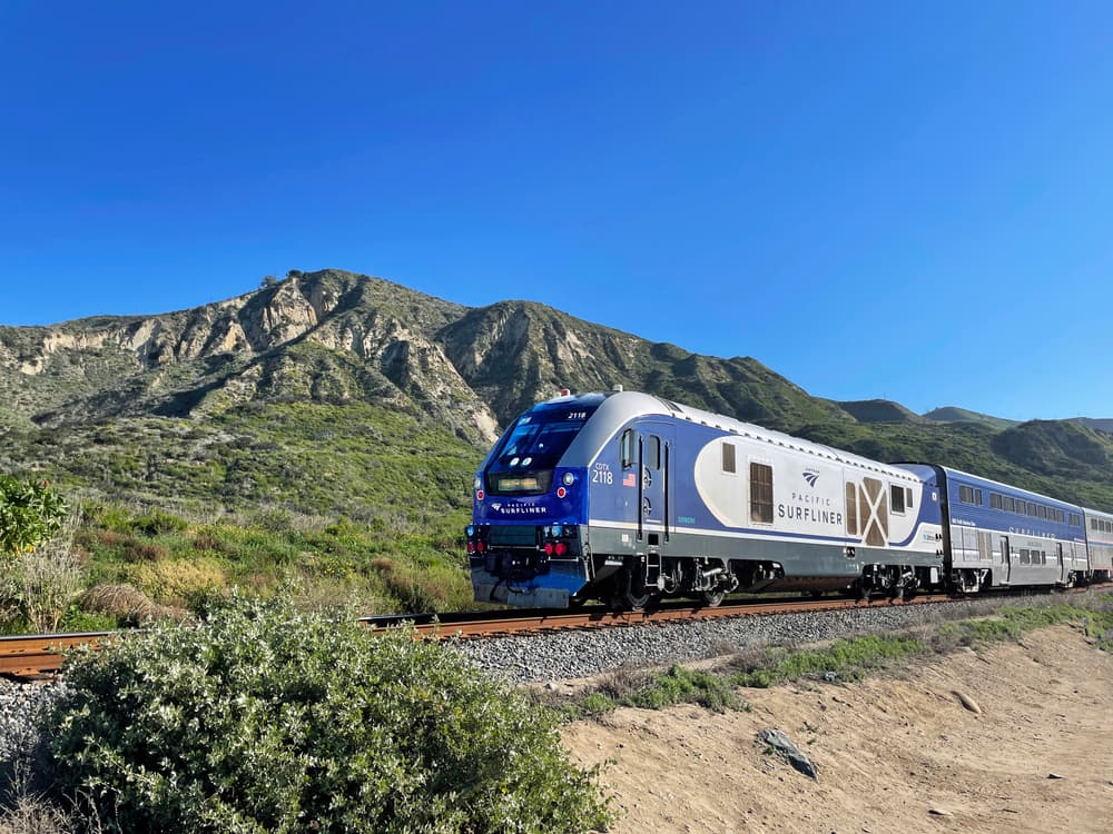
Amtrak’s Pacific Surfliner runs along the coast between San Diego, Los Angeles and Santa Barbara, with some trains continuing to San Luis Obispo. It is a pleasant, scenic alternative to driving, taking roughly three hours between Los Angeles and San Diego.
The Coast Starlight runs once a day in each direction between Los Angeles and Seattle via Santa Barbara, San Luis Obispo, San José and Oakland. It is beautiful and slow — around eleven to twelve hours from Los Angeles to the Bay Area — and delays are common. Treat it as an experience rather than transport.
There is no direct train between downtown San Francisco and Los Angeles; the journey involves a bus connection or a change. Trains do not reach Yosemite Valley, Big Sur, Lake Tahoe’s shore or the desert parks.
Urban transport: BART, Caltrain, Muni and LA Metro
In the Bay Area, BART links SFO and Oakland airports with downtown San Francisco, Oakland and Berkeley. Caltrain runs down the peninsula from San Francisco to San José. Within San Francisco, Muni buses, trams and the famous cable cars cover the city; a contactless Clipper card or phone wallet works on all of them.
Los Angeles has a growing Metro rail network that is useful for a few visitor routes — downtown to Hollywood and Universal City, and downtown to Santa Monica — but the city is vast and many sights are far from a station. Most visitors combine Metro, ride-hailing and a rental car. San Diego’s trolley connects downtown with Old Town and the Mexican border.
Buses, flights and tours
Long-distance buses connect the main cities cheaply. Short flights between the Bay Area and Southern California take about 90 minutes and are frequent. For the national parks, seasonal YARTS buses run into Yosemite from gateway towns, and guided day tours from San Francisco, Los Angeles and Las Vegas fill the gap for travellers without a car.
Distances and drive times
Typical driving times in normal conditions without stops. City traffic, roadworks, snow and summer queues at park gates can add a lot.
| Route | Distance | Drive time | Notes |
|---|---|---|---|
| San Francisco – Los Angeles | 380 mi / 610 km | 6–6.5 h | Fastest inland route on Interstate 5 |
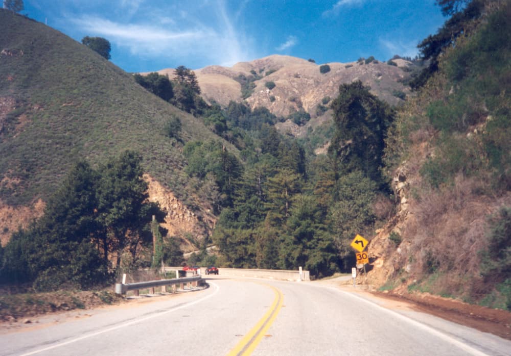
| San Francisco – Los Angeles | 460 mi / 740 km | 9–10 h | Via Highway 1 and Big Sur; allow two to three days and check for closures |
| San Francisco – Yosemite | 170 mi / 275 km | 3.5–4 h | To Yosemite Valley via Highway 120 or 140 |
| San Francisco – Napa & Sonoma | 50 mi / 80 km | 1–1.5 h | Longer at weekends and in the evening rush |
| San Francisco – Big Sur & Monterey | 120 mi / 195 km | 2–2.5 h | |
| San Francisco – Lake Tahoe | 190 mi / 305 km | 3.5–4 h | Chain controls possible in winter |
| Big Sur & Monterey – Santa Barbara | 240 mi / 385 km | 4–4.5 h | Via Highway 101; longer along the Big Sur coast |
| Santa Barbara – Los Angeles | 95 mi / 155 km | 1.5–2 h | Can double in rush-hour traffic |
| Los Angeles – Anaheim & Disneyland | 26 mi / 40 km | 0.5–1 h | Can double in rush-hour traffic |
| Los Angeles – San Diego | 120 mi / 195 km | 2–2.5 h | Can double in rush-hour traffic |
| Los Angeles – Palm Springs & Joshua Tree | 107 mi / 170 km | 2 h | |
| Palm Springs & Joshua Tree – Death Valley | 290 mi / 465 km | 4.5–5 h | To Furnace Creek |
| Los Angeles – Death Valley | 270 mi / 435 km | 4.5 h | To Furnace Creek |
| Las Vegas – Death Valley | 120 mi / 195 km | 2 h | To Furnace Creek |
| Los Angeles – Sequoia & Kings Canyon | 200 mi / 320 km | 3.5–4 h | To the Ash Mountain entrance; another hour of mountain road to the Giant Forest |
| Yosemite – Sequoia & Kings Canyon | 170 mi / 275 km | 3.5–4 h | To the Ash Mountain entrance; another hour of mountain road to the Giant Forest |
| Yosemite – Lake Tahoe | 190 mi / 305 km | 4–4.5 h | Via Tioga Pass — summer and early autumn only |
| Yosemite – Death Valley | 300 mi / 485 km | 5.5–6 h | Via Tioga Pass — summer and early autumn only |
Transport FAQs
Can I travel around California without a car?
Partly. San Francisco is easy on foot and by public transport, the Pacific Surfliner links San Diego, Los Angeles and Santa Barbara, and tours reach Yosemite, wine country and Death Valley. Big Sur, the deserts and the mountain parks are difficult without a car.
Which airport is best for a road trip?
Fly into SFO or OAK and out of LAX or SAN (or the reverse) to avoid backtracking. For a parks-and-desert trip, Las Vegas can be a convenient start or end point.
How do I pay the Golden Gate Bridge toll in a rental car?
There are no toll booths. The toll is recorded electronically and charged through your rental company’s toll programme, or you can make a one-time payment online using the car’s number plate within the time allowed. Ask at the rental desk.
Is driving in California difficult?
Freeways are wide and well signed, but traffic in Los Angeles and the Bay Area is heavy and distances are long. Highway 1 through Big Sur and mountain roads in the Sierra are narrow and winding; allow extra time and avoid driving them in the dark.